Half-heard dialogues about
the reading and notation of landscape. From Map and Photo Reading Answer Book,
T W Birch, London 1956.
1998
[1]
“No, of country.”
“By water, it is in the valley.”
“No.”
“A steep bank.”
“Summer, foliage.”
“The farm-house.”
“To contain the stock.”
“In the fields.”
“By dotted marks arranged in arcs.”
“Yes.”
“No.”
“Timber.”
“South-west.”
“Yes.”
“Indicated by the small divided doors.”
“The houses are situated far apart.”
“South-east.”
“No.”
“No.”
“To keep the animals at a distance.”
“South-west.”
“No, by referring to the plan.”
“Yes, housing the pump.”
“Yes, to the left side of the gate.”
“No.”
“Left or north-east.”
“Behind.”
“Solid line, broken line.”
“Yes.”
“Morning, shadows falling to the north-west.”
“Wood, bricks, tiles.”
“An eighth.”
“An orchard.”
“Right or north-west.”
“South-west, as indicated by the arrow.”
“It goes under the road.”
“A footbridge.”
“South-west.”
“Yes.”
“No.”
“From north-west to south-east, from south-west to north-east.”
“Footpath and drive.”
“Terraced land.”
“Shallowness.”
“No direct route.”
“The stream direction.”
“North-east as the stream flows south-west.”
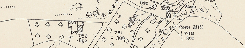
“P for pump.”
“No fields, rough grass and gorse, a sand-pit.”
“South-east.”
“Where the stream leaves.”
“Millpond and sluice would be above the mill.”
“Steady water flow.”
“Marking limits of acreage.”
“North, west.”
“None.”
[2]
“No.”
“No, unusual view or aspect.”
“Fields.”
“Roads.”
“Trees and shadows.”
“Railway line.”
“No.”
“Yes.”
“Yes, yes; no, the extent differs.”
“Yes.”
“No.”
“Four or five.”
“About the same; hedges and trees.”
“Yes.”
“No.”
“Names, altitudes.”
“Yes, two.”
“After, the shadows are slightly to the east.”
“Black.”
“Grubbed up.”
“Farming.”
“Poor quality land.”
“Stripes.”
“No, but largely it appears to be.”
“No, but possibly by land use; for example, common, parkland, agriculture.”
“No, no.”
“Yes, the houses, variety of crops and the planting of new fruit trees.”
“Yes, a path.”
“Yes, yes.”
“No.”
“Winding and narrow.”
“Near the middle of it.”
“Rural, few houses.”
“Fields.”
“Yes.”
“Single line railway; signal post.”
“Rising.”
“Wood with undergrowth, tree signs.”
“Mile post.”
“Streams and pools.”
“Rough pasture, parkland.”
“Numbers and areas.”
“Yes.”
“No, yes.”
“No.”
“Along the hundred-foot contour.”
“Two sand-pits.”
“No.”
“Railway cutting and embankment.”
“No, south and east, no.”
“No, south.”
“Thirty-nine feet in nearly half a mile.”
“Contours.”
“Yes.”
“North-west, no.”
“Brown a hundred feet, brown twenty-five feet.”
“East, by the contour near the pool side.”
“Yes, no.”
“Twelve to fifteen minutes.”
“No, possibly.”
[3]
“Yes, in the south-east.”
“Trees.”
“White.”
“To the right.”
“No.”
“Hilly.”
“Left.”
“Hedges, bushes, trees.”
“Yes.”
“No, no.”
“No.”
“White bands.”
“No, yes.”
“A road.”
“To the north-east.”
“Difference in colour.”
“No.”
“Gault clay.”
“South.”
“Near the bottom.”
“Steep, pure chalk with no soil.”
“More hilly.”
“Grass, trees.”
“At the foot of hills at the chalk-clay junction.”
“Grey or black, white, blue.”
“South.”
“North, least built-up; yes.”
“Contours, altitude.”
“Blue.”
“Yes, no.”
“Facing south and south-east, east, south-east.”
“Miles, feet above sea-level, a road number.”
“Orange, grey, black, blue.”
“Walkers, dotted line with FP marking.”
“Names and mileage on roadsides.”
“Two farms, a brick works, a chalk pit, a reservoir.”
“Indication of a railway line, tunnels.”
“Footpath, a well, a boundary stone, trig. station.”
“Slightly larger.”
“The scale is too small; west, east.”
“Hachures.”
“The land is very irregular.”
“Porosity of chalk.”
“Deciduous trees.”
“Less crowded with more regular pattern.”
“A milestone, feet above sea-level.”
“Without a tower or spire, with a tower, with a spire.”
“The north from the contour pattern and numbers.”
“In an easterly direction, V-shaped contours upstream.”
“Under railways, no.”
“Blue line.”
“Chalk pit, the word coombe as a prefix to both farm and wood.”
“A station, a school, an embankment; both deciduous and coniferous trees.”
“Blue, not shown.”
[4]
“Snow, rocks or boulders.”
“Flat, yes.”
“View indicator.”
“Mountain valley.”
“Fairly steep.”
“Snow on the upper slopes and summits.”
“Coniferous, Scots pine.”
“Rough grazing.”
“Background, foreground.”
“Snow, but not continuous.”
“None.”
“Plateau.”
“North.”
“Four miles.”
“No.”
“No.”
“Grazing for sheep and deer.”
“Crescent or U-shapes.”
“On the right.”
“Spot height at the top of the cliffs.”
“Not given.”
“Right, left.”
“Nil.”
“They usually mark routes and summits.”
“Flat tops, loose boulders.”
“Lack of sun.”
“Lack of soil, adverse climate, including wind.”
“Bare rock, scree.”
“No, no.”
“Coniferous.”
“Near side, the climb.”
“One-inch to the mile.”
“South-east.”
“Contours, cliffs.”
“Blue, yes.”
“Woods, coniferous.”
“No.”
“Two and a half miles.”
“One kilometre, no.”
“Rough grazing.”
“Crowding of contours, widely spaced contours.”
“Yes.”
“Dash-and-dot line.”
“Compass.”
“Ten miles, relief.”
“Fifty feet, two hundred and fifty feet.”
“Three.”
“Yes.”
“V-shaped, indicating water erosion.”
“Fifteen hundred feet.”
“No.”
“Map and compass.”
“Six-inch, too uninhabited to necessitate larger scale.”
“Yes.”
“Boundary.”
“About ten.”
“Disappears below ground for two miles.”
“Col, saddle or pass.”
“Names, boundaries, rough grazing, spot heights.”
“Yes, by triangles.”
[5]
“No, east.”
“Flowers.”
“A windmill.”
“Glasshouses lining the back of the field.”
“Early.”
“Yes.”
“Fences missing.”
“Dredged and straightened.”
“Grass.”
“Draining.”
“Both flat.”
“Similar conditions and soils.”
“Pumping water.”
“Passing the mill and houses.”
“Cattle, but sheep in marshes.”
“Remain free of flooding.”
“Roads flat but windswept.”
“River acting as a fence.”
“No.”
“Erosion, deposition, yes.”
“Packing.”
“Railways.”
“Peaty, deep.”
“No.”
“Increases gradient.”
“Along the edge of the water, yes.”
“No, no.”
“Speed, yes, no.”
“Heating of the glasshouses.”
“Much, no.”
“No.”
“No.”
“No, almost certainly.”
“High.”
“Flat.”
“Eight miles, north.”
“No.”
“Middle one; artificial, natural.”
“Yes, no.”
“Farming.”
“No.”
“Minor roads, one side unfenced.”
“Milepost, ten feet above sea-level; house, bridge.”
“Fields of flowers.”
“Yes, no.”
“Nil, total submergence.”
“Fodder lots.”
“Straight stretches of waterways, roads and railways.”
“Tarred road, embankment, boundary, ditch.”
“Level crossings.”
“Medium.”
“About nine and a half miles.”
“Spacing of mileposts and stones.”
“Class B passing hall.”
“Yes, no indication of marshland.”
“Drain, river.”
“Windmill indicated as disused and not near any glasshouses.”
“No.”
“Varies.”
“Five.”
“Contrast in types.”
“One quarter.”
“More, two.”
“Multiple to single track, bridge, level crossing.”
“Intersection.”
“No, yes, yes.”
“Vice-versa.”
[6]
“Hilly or mountainous, no.”
“Fairly flat topped, left.”
“North-west.”
“No.”
“Carboniferous limestone.”
“Yes, hard.”
“Stone walls.”
“No.”
“To take advantage of the valley, neither.”
“Cloud shadows.”
“Coniferous, deciduous.”
“Grassland.”
“High bank on the outside of bend.”
“Farm-houses.”
“Sheep grazing.”
“Walls are dry-stone construction, the bridge is mortared.”
“Gorge.”
“Walled fields.”
“Called becks or gills, scars.”
“Rough grass.”
“Erosion on the outside of bends, deposition on the inside.”
“Altitude and north-westerly position.”
“Stock require more attention.”
“No.”
“No, more fertile.”
“First has hedges, the second has walls.”
“Streams caused dales, solubility of limestone.”
“Hard, because of alkalinity of limestone.”
“Local wool, some water power; hardness of the water, communications probably poor.”
“Abrupt steps in profile.”
“They change course and position.”
“Winters less severe lower down, sheep more easily attended, food more plentiful, less snow.”
“No, no, yes, no.”
“Five and a half miles, about two hours or more.”
“Pure limestone, all soil washed away.”
“Denudation.”
“Through joints and fissures underground.”
“Contours, fifty feet, steep where close.”
“East-north-east.”
“South-west.”
“They disappear underground.”
“South centre and south-west, the land is lower and flatter.”
“Lead.”
“Closed railway station.”
“Contours are more crowded on the left or north-west side.”
“Hill, top, scar, beck, hole.”
“Lead mining, livestock grazing.”
“Contours are crowded along the river sides.”
“Rough pasture.”
“Sheep rearing.”
“In between.”
“The lower land, river and shape.”
“Probably three or more large boulders.”
“On the flatter land, layer of horizontal permeable rock like limestone.”
“Absence of communications, villages and discontinuation of streams.”
“In the north-west.”
“Hanging valleys, truncation of spurs.”
“Undulating.”
“By about sixty feet.”
“Pass or saddle, boundary.”
“Three counties meet.”
“Very little, rough grass and heather, rough grass, moss.”
“Along the road.”
“Church, post office and inn.”
“Sheep and cattle farming.”
[7]
“North, left or west, left or west.”
“Out.”
“Facing opposite directions.”
“In.”
“Hilly.”
“Gently.”
“About seven miles.”
“Summer, trees in leaf.”
“Probably.”
“Hedges of fields.”
“Lettering on roofs readable from steep hill behind.”
“Farther south.”
“No.”
“Yes.”
“Both are low rounded hills.”
“Not chalk.”
“No.”
“No.”
“Rocky coastline.”
“Width of dotted area.”
“Sand is shown by dots, rocks by rock drawings.”
“When magnified, material is angular, yes, yes.”
“Pebbles used locally to make the roads.”
“Yes, down and point.”
“Footpath, following line of houses.”
“Ground uneven, levels change.”
“These, exposed to gales.”
“South-west, south-west, north-west, north.”
“North, south.”
“Dunes.”
“Yes.”
“North and south-east, centre.”
“Grass.”
“No, sandbanks.”
“No.”
“Thirty feet.”
“Rail and road routes following the river valley.”
“Rough grass, woods.”
“Marsh.”
“Passenger ferry.”
“All are inland.”
“From the land.”
“No, no, no.”
“Filled by the rivers.”
“Waves and winds.”
“Eroded away.”
“Previously a water-front street.”
“Suggested hilly country north, flat lowland south.”
“Heavy rainfall, low hill-grazing; indifferent communications.”
“Stream course undefined.”
“Undulating, hummocky, hilly, rolling.”
“Inland.”
“Southward.”
“No.”
“By embankments.”
“By keeping to higher land.”
“Too wide, little traffic. “Boundary, footpath.”
[8]
“Straightened and broader, slower flowing.”
“Mountainous and isolated.”
“Drainage channels cut.”
“To cross stream, narrow valleys.”
“Following contours.”
“No.”
“Signs with road numbers.”
“Sheepfold.”
“Regular street pattern.”
“Both are easily defined boundaries, watershed.”
“Clouds and mist frequently obscure landmarks.”
“No.”
“No, yes, yes.”
“Changes of rock, contour spacings and patterns.”
“Uneven, variety of rocks and altitudes.”
“Erosion at high altitudes, depositon at low altitudes.”
“By contours.”
“Steepest where crowded, yes.”
“Rivers, locks.”
“Five-eighths of an inch.”
“Forests, bridges, ferries, fords.”
“High and low land, streams, rivers.”
“Probably; six-inch, two and a half inch, one-inch.”
“A bench mark.”
“Largely, yes.”
“Vertical intervals.”
“By arrow-heads, straightness.”
“Straighter, often following the contours, a dam.”
“One-inch, between.”
“Indicated as a centre of communications, no.”
“Drainage.”
“Small.”
“Churches, level crossings.”
“Up, twice.”
“Meanders, flat, yes.”
“Mountain, marsh.”
“Between.”
“Dry building spots, places with a water supply.”
“Not necessarily of the same date.”
“A plan, as differentiated from a map, has all features true to scale.”
“Spot heights, bench marks and trig. stations.”
“Artificial, pervious rock layer, impervious outcrop below pervious layer.”
“About two feet.”
“Change of rocks; changes in density, size, shape, distribution, functions, occupations.”
“Mountains, marsh, forest, poor soil, thin soil.”
“Lakes, streams, variation in altitude, dammable valleys.”
“Valleys.”
[9]
“No.”
“Yes.”
“Sand, gravel, boulders.”
“Two.”
“Then tree signs are in rows.”
“Direction of flow, no.”
“Above and on level, yes.”
“Diagonal shading.”
“Electrical transmission line.”
“Coppice.”
“Wet, poorly drained.”
“Dots.”
“Top, yes.”
“No.”
“Yes.”
“P.”
“Signal post.”
“Along roads.”
“A boundary stone.”
“Outcropping rocks and boulders.”
“Yes, yes.”
“Feet.”
“Two, three.”
“Obvious in the field.”
“Pp.”
“Ten, yes.”
“Yes, fruit from orchards.”
“No.”
“One.”
“Yes.”
“Bench marks and spot heights.”
“Streams with direction indicated, ponds, canals.”
“Rough pasture; osiers, reeds.”
“Quarries, pits, refuse heaps.”
“Railways.”
“Yes, on road signs.”
“Blue.”
“Deciduous.”
“Orange, black.”
“More.”
“No.”
“Red triangles, both formats used by walkers.”
“Motorists.”
“Broken orange line and letter B.”
“A railway.”
“Trigonometrical station.”
“Boat.”
“Gorse, its symbol not in blue.”
“Two.”
“Triangulation station, yes.”
“Yes.”
“A gravel pit symbol.”
“Five.”
“Yes, the letter P.”
“No.”
“Mud.”
“Willows generally associated with water.”
“Word plus arrow.”
“Depth.”
“No.”
“Kilometre, no, no.”
“Right centre.”
“A red dot and bar edged with black.”
“Low and high-water marks.”
“Higher.”
“Classification of roads.”
“About 6 inches or miles.”